
Nainital, 18 Jan 2024: After the Joshimath landslide, a geotechnical and geophysical survey will be conducted to save Nainital city which is in danger and to prepare future construction plans. Apart from this, slope stability will also be surveyed in Nainital. For this, the Landslide Mitigation and Management Center has started the process. Besides, Lidar map of the city will also be prepared.
In fact, after the Joshimath landslide, the government had decided that the carrying capacity of all the hill towns would be assessed. In this series, 15 cities were selected in the first phase. First of all, a survey will be conducted to assess the carrying capacity of Nainital as well as to protect it from land subsidence. Under this, Lidar (Light Detection and Ranging) map of Nainital will be prepared. This technique is used to create high-resolution maps.
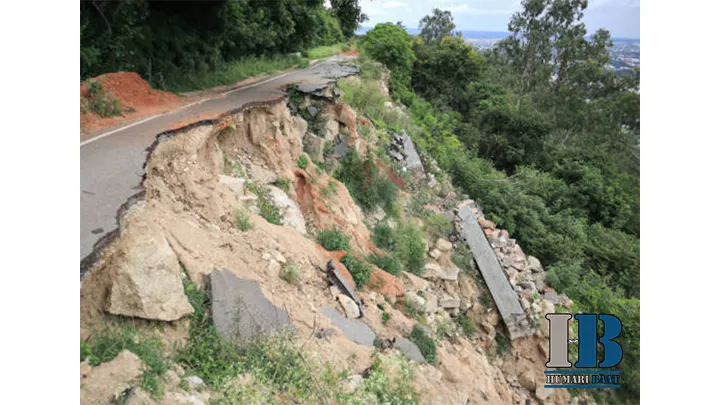
Ballia drain, which is considered the foundation of Nainital, is continuously coming under the threat of landslides, its treatment has also been started. At the same time, landslides are active in the top Naina Peak of Nainital, the side Tiffin Top and the beautiful hill of Snow View.
By making Lidar map after land survey, it will be clear up to what height the buildings in the city are safe. What is the burden on the city due to the buildings already built? On how many slopes, on how many floors, are there buildings which are at risk from disaster. Buildings with how many floors should be built on how many degrees of slope. What are those lands and places in hilly cities where building a building can be dangerous? In future, the entire work from new construction to sewer and drinking water will be done according to the same map. The master plan for this will also be made accordingly.
These 15 cities will be studied in the first phase
Gopeshwar, Pauri, Srinagar, Karnaprayag, New Tehri, Uttarkashi, Lansdowne, Ranikhet, Nainital, Kapkot, Dharchula, Champawat, Pithoragarh, Almora, Bhawali.


